The ocean, which covers 71% of the earth and is home to abundant and diverse wildlife, is still largely unexplored. Much of the ocean is inaccessible to humans because of the high pressures that result from diving too deep under the surface. Therefore sonar plays a key role in cataloging and diagraming the ocean floor. A ship will navigate into uncharted territory, and the Sonar system will send a "ping" to the bottom of the ocean, where the signal will bounce back to the ship.
| sonar_mapping.mp4 |
| sonar_based_simultaneous_localisation_and_mapping.mp4 |
The two videos shown above demonstrate how sonar is used for mapping.
With the aid of sonar, scientist have been able to see the ocean floor without physically having to go into the ocean. Scientists can now see the disperse wildlife and habitats that are all on the sea floor, these include coral reefs and sea grasses. This is all shown through sonar and cameras.
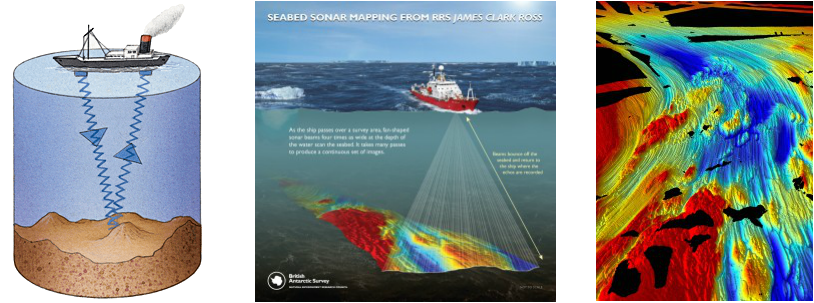
This images display how Sonar is used to map the ocean floor and the features on it.
