The Titanic, which sank on April 14, 1912 was excavated by a French and American Team using sonar. The French Team used a type of sonar known as SAR(Sonar Acoustique Remorque). SAR emits sound waves that rebound off the ocean floor, giving an image of what lies underwater. SAR covers a wider expanse of the ocean floor, and because sonar is able to map 3-D images, it gives a clearer idea of objects beneath the surface.

The bow and main body of the ship.
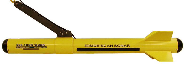
The type of sonar used to locate the Titanic was a side-scanning sonar. It is used as shown on the right.
|

|
"After combing the site with new undersea robots, the team was able to verify the ship's identity with cameras and sonar early Sunday morning, according to American and French officials. A French announcement said the wreck was found at a depth of more than 12,000 feet."
-William J. Broad
-William J. Broad

"In collaboration with the Woods Hole Oceanographic Institution, NatGeo recently completed the most comprehensive map of the entire wreckage site of the Titanic. Using using a blown-up sonar survey map of the site along with high resolution photos the team meticulously stitched-together the shots and created a virbrant 3D mosaic taken of the infamous wreck at her final resting spot 2.5 miles beneath the ocean’s surface."
